Acquisition Number: 1968.100.001
Original work:
Original size: 26 by 41.25 inches
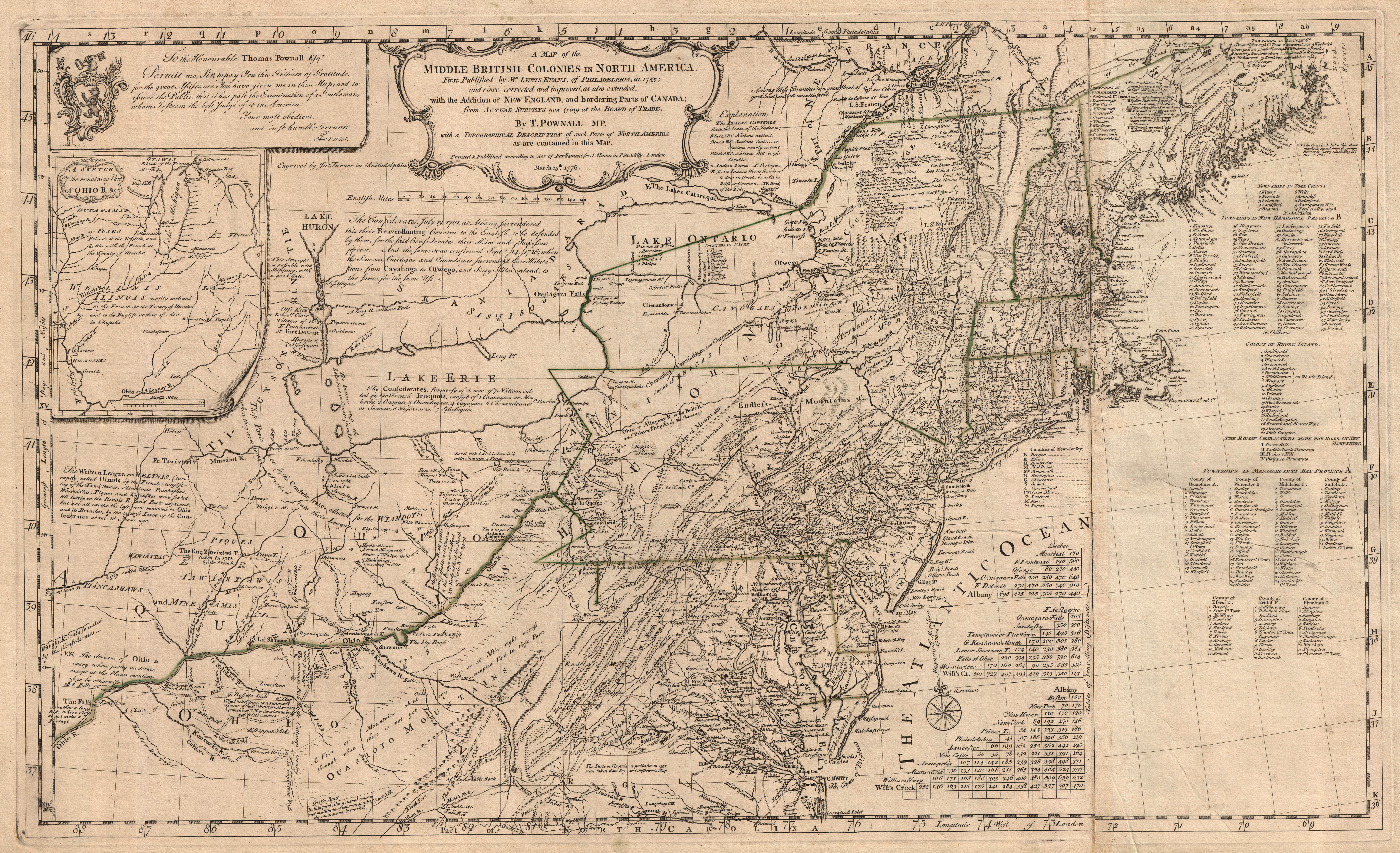
One topographic map entitled ”A Map of the Middle British Colonies in North America.” The map was originally published by Lewis Evans of Philadelphia in 1755 and was updated by Thomas Pownall. This updated version was printed by J. Almon of Piccadilly, London, England, and is dated March 25, 1776. The map area covers the Atlantic coast of North America from Norfolk and Cape Henry, Virginia, northward to the Passamaquoddy River, Maine. The map area extends westward to Fort Detroit (Fort Pontchartrain) and southwestern Ohio. A small inset map extends the area of coverage to the Mississippi River. Map details are drawn in black ink on slightly yellowed paper with green ink being used to show colony boundaries. Map information includes towns and forts, mountain ranges, rivers, lakes, Indian tribal regions, and travel distance tables as well as lines of latitude and longitude. Township names are listed for the colonies of Massachusetts, New Hampshire, and Rhode Island.
Reproduction Size: 19.5 x 32
|

