Acquisition Number: 1968.100.001
Original work:
Original size: 10 by 14.875 inches
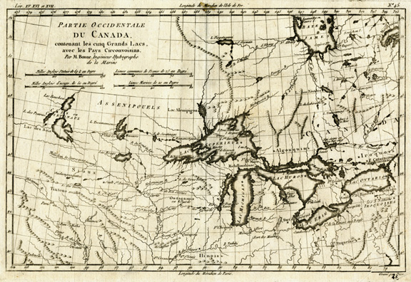
Map titled ”Partie Occidentale Du Canada. contenant les cinq Grand Lacs, avec les Pays Circonvoisins. Par M. Bonne. Ingenieur-Hydrographe de la Marine” [Western Part of Canada, containing the five Great Lakes, with the surrounding country. By M. Bonne, marine hydrographic engineer] representing part of what was then western Canada, the Great Lakes region, and the surrounding country, including what is now the upper Mississippi River Basin, from the late 18th century. The map includes names of major territories, forts, settlements, lakes, rivers, and some mountainous areas. Title block and four scales are located on the top left corner of the map. Printed text along the top left edge reads ”Liv. XV. XVI et XVII.” Printed text along the top right edge reads ”No. 45.” Printed text along the bottom right edge reads ”Grave pas Dien 46.” Lines of latitude and longitude are indicated along the perimeter of the map.
Reproduction Size: 20 x 25.75
|

